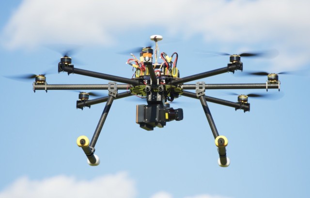
Australia’s leading researchers of Remotely Piloted Aircraft Systems (RPAS) technology have been recognised by Australia’s CSIRO with exclusive backing to oversee the development of collision avoidance technology over the next three months.
The Australian team behind perhaps the most innovative RPAS solutions for remote sensing, Hovermap, has been selected to take part in the next round of CSIRO’s ON Accelerator. The proposed collision avoidance technology is necessary to ensure safe, efficient and responsive navigation by RPAS. The ON Accelerator program aims to boost Australia’s innovation performance by accelerating big science and technology ideas into commercially viable opportunities over a period of three months.
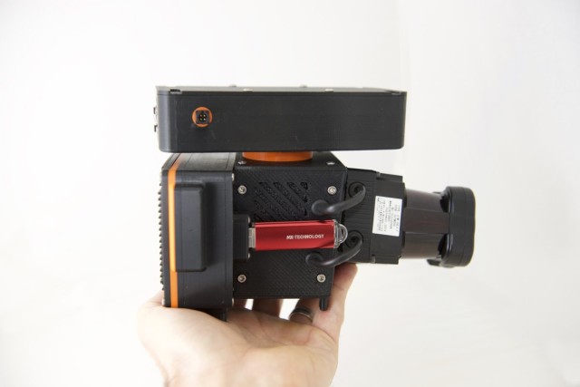
The existing Hovermap system, developed by CSIRO researchers, is itself revolutionary for its combination of LiDAR technology and it’s 360×360 degree senor capabilities. The Hovermap payload gives a spherical view around the vehicle, and that sensor data can also be used in real-time for the vehicles navigation and safety. The sensor achieves this impressive spherical view by rotating relative to the vehicle, using similar algorithms as CSIRO’s Zebedee precise handheld scanner. This Hovermap sensor data will then be used to inform collision avoidance algorithms, and eventually, true autonomy.
Dr Stefan Hrabar, the Principal Research Scientist and Research Team Leader at Hovermap, said to Spatial Source that he envisages three distinct stages of development towards the evolution of autonomous detect and avoid algorithms.
- Warning systems
Much like existing reverse parking sensors or lane detection technology, this initial phase of the technology acts to provide notifications or warning systems to inform the RPAS operator of detected obstacles. The operator then reacts manually to the supplied information. There are obviously limitations to this in terms of human error and also the minute times and distances within which collisions may occur.
- Automatic avoidance
The next level of development will involve both operator and machine input. In the case that the operator attempts to fly the RPAS into an obstacle, the system will automatically refrain from navigating towards it. The operator can then resume navigation by choosing another alternative routing. The problem with this however are the problems involved with beyond visual line of sights (BVLOS) operations and incompatibility with dynamic.
- True autonomy
True autonomy will permit the system to navigate itself safely and efficiently in any environment, independent from human operation. Once made possible, it will be possible for systems to be given directions to investigate an entire cavern system and return once all features have been mapped to the desired level of resolution. The potential applications go well beyond mapping, to logistics, surveillance, arts and even to autonomous vehicles.
The Hovermap solution is unique in that it will operate independently form satellite navigation (or GNSS), meaning that it can be used underground, indoors or among large buildings.
Dr Hrabar points out that the mapping applications are in fact independent from the collision avoidance technology: “The collision avoidance algorithms that we have developed are not specifically tied to the mapping hardware that we currently have.”
“You can imagine in the future pretty much every UAV is going to need some form of collision avoidance.”
“In a few years time, pretty much every UAV you buy, off the shelf, will have these collision avoidance sensors on board and they will need the algorithms that we are developing right now.”
The three month ON Accelerator program is focussed on assessing the business opportunities and commercialisation of the system, so the Hovermap team are consulting with customers and potential investors to oversee the best way forward to develop and roll out the technology. Depending on their findings, after the three months we may see the establishment of a company called “Hovermap,” or the rollout of the technology more broadly.
The Hovermap team are looking to establish an early adopter program once they have prototypes ready in the coming 3-6 months. From there, Dr Hrabar expects that there will be approximately 12 months until a commercial Hovermap system is available, with true autonomy available within 2-3 years.
From July this year the ON Accelerator program will be expanded nationally to include all other publically funded research organisations, as well as Australian universities, as part of the Federal Government’s National Innovation and Science Agenda.
Source: Spatial Source


