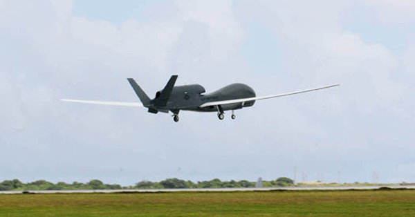
An RQ-4 Global Hawk takes off in October 2010 from Andersen Air Force Base, Guam - Photo: US Air Force
When the Japanese government began to fear a nuclear disaster after the March earthquake and tsunami, the US Air Force sent a Global Hawk based in Guam to help.
The RQ-4 Global Hawk arrived 22 hours after the earthquake struck, and the images they captured identified the boundaries of the radioactive plume around the island. But getting a read on what was going on inside the damaged nuclear power plant took a little more ingenuity. The Japanese government asked if the Global Hawk could use its infrared cameras to determine the temperature inside the Fukushima Dai-ichi power plant — a possible warning of a meltdown. They couldn’t, but airmen figured out that the plane could record the temperature in its area over time and compare the results.
“If we take an image of the temperature of the reactor and we come back the next day and take an image and it’s hotter, then we know we have a problem,” said Lt. Col. Ricky Thomas, Global Hawk functional manager.
Over the next two months, the Global Hawk flew 20 missions, spent more than 300 hours circling the site of the power plant and snapped thousands of images to share with the Japanese government and aid groups, Thomas said.
“It was the best [remotely piloted aircraft] for the job,” Thomas told reporters at the National Press Club recently. “We could park the Global Hawk over Japan flying from Guam for up to 20 hours and dynamically task it.”
The Global Hawk had arrived at Andersen Air Force Base, Guam, six months before the earthquake and wasn’t intended to fly operationally for about another month because one of the communication terminals was broken and needed repair.
“The president of the United States said, ‘I need information now,’ ” Thomas said. “This was the only asset to provide that broad view.”
The Japanese earthquake wasn’t the first time the Global Hawk was used for humanitarian missions. It has flown over fires in California and also provided imagery after a 2010 earthquake destroyed much of the Haitian capital, Port-au-Prince.
Source: Air Force Times
