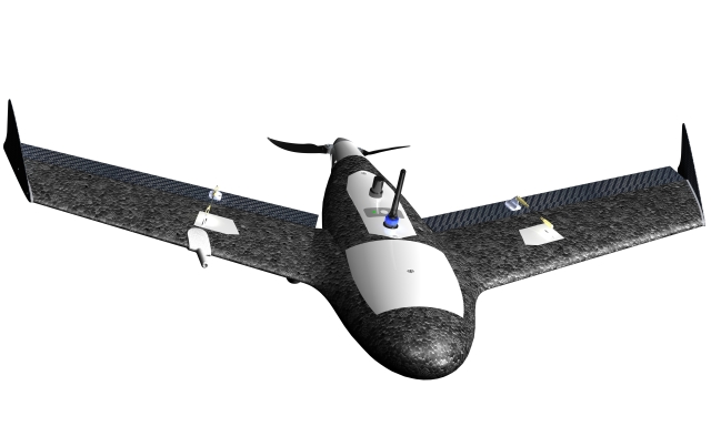
 Trimble announced that it has acquired privately-held Gatewing of Gent, Belgium, a provider of lightweight unmanned aircraft sytems (UAS) for photogrammetry and rapid terrain mapping applications.
The acquisition broadens Trimble’s industry-leading platforms for surveying solutions. Financial terms were not disclosed.
UAS in combination with photogrammetry are an emerging technology providing an innovative platform for flexible aerial imagery acquisition. Easy to use and flexible, UAS provide users the ability to create orthophotos and Digital Surface Models (DSM) from aerial imagery for mid-sized areas previously only accessible at higher costs and with longer planning cycles. UAS are used in a variety of applications including preliminary surveys for corridors and rights-of-way, volumetric surveys, high-level topographic surveys, land fill inspection, and much more.
Gatewing’s solutions include the X100 UAS and Stretchout desktop software for digital image processing and analysis. The X100 is an ultra-light, 2 kg (approximately 4.4 lbs) class UAS that allows fast and simple image acquisition. It consists of an airframe; an integrated GPS, inertial system and a radio; a 10 megapixel camera; and battery. Using the Trimble Yuma tablet computer, a predefined area is planned and the flight of the UAV is fully automated from launch to landing. The terrain is mapped through parallel flight paths and consecutive, overlapping camera shots during flight. The ground control station (GCS) is used to monitor the mission and allows an on-site image quality check. In addition, the GCS provides the operator with the option to intervene and abort the flight if needed. The image set consists of a number of digital images that are tagged with the GPS coordinates.
Designed to be intuitive and easy to use, Gatewing’s Stretchout desktop software uses advanced computer vision technology which automates raw image processing to deliver georeferenced orthophotos and accurate DSM. As an alternative to the desktop software, users can upload images to Gatewing’s cloud solution, which automatically processes the images based on the users’ requirements. After a few hours, users can download their georeferenced orthophotos and DSMs from the cloud server including feedback about the results for quality assurance.
“The combination of UAS and low-altitude photogrammetry as an image collection platform opens up new opportunities for surveyors to use aerial imagery for the rapid acquisition of high-density geospatial data,” said Anders Rhodin, director of Trimble’s Survey Business. “We are excited to add Gatewing’s unique aerial mapping system to Trimble’s portfolio of survey solutions.”
“The Gatewing team is excited about the new ownership,” said Maarten Vandenbroucke, CEO and one of three founders of Gatewing. ”For Trimble to see the value in unmanned aircraft systems for surveying and mapping applications means that the industry is truly ready for this exciting new technology. We are enthusiastic about how UAS can revolutionize the landscape and open a complete new spectrum in remote sensing applications. I believe that being a part of Trimble will accelerate the pace in which UAS will further be adopted by professionals.”
The Gatewing business will be reported as part of Trimble’s Engineering and Construction segment.
Founded in 2008, Gatewing designs and provides one of the world’s fastest and easiest to use remote sensing solutions for the surveying and mapping industry. Based on its revolutionary X100 lightweight unmanned aircraft, Gatewing has built a solution for rapid terrain mapping that consists of image acquisition field operation and fully digital and automated image processing. By making this technology highly accessible in terms of price and ease of use, Gatewing’s goal is to revolutionize the surveying and mapping industry.
Trimble applies technology to make field and mobile workers in businesses and government significantly more productive. Solutions are focused on applications requiring position or location—including surveying, construction, agriculture, fleet and asset management, public safety and mapping. In addition to utilizing positioning technologies, such as GPS, lasers and optics, Trimble solutions may include software content specific to the needs of the user. Wireless technologies are utilized to deliver the solution to the user and to ensure a tight coupling of the field and the back office. Founded in 1978, Trimble is headquartered in Sunnyvale, California.
Source: Press Release
