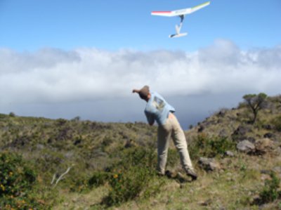
Scientists at the US Geological Survey’s Northern Rocky Mountain Science Center are actively exploring the use of small unmanned aircraft system (sUAS) for sensor testing and scientific data collection.
They are using the same sUAS deployed by the US Department of Defense. These systems have proven their utility in reconnaissance missions and are now finding a second life in scientific research.
A team of pilots operate the Raven RQ-11A aircraft, a Global Positioning System guided sUAS with interchangeable nosecones that provide several options for video data collection.
 The electrical optical (EO) camera captures and records video data in the same fashion as a standard video camera. This type of data collection can be used to show ecological variables such as habitat quality, vegetation cover and landscape changes over time. The US Geological Survey successfully deployed an EO equipped Raven along the Missouri River to capture images of sediment transport and erosion.
The thermal infrared (IR) camera collects video data on the thermal characteristics of landscapes and other objects. This type of data collection has both biological and hydrological applications. For example, the US Geological Survey has deployed IR equipped Raven aircraft at the Monte Vista National Wildlife Refuge (NWR) to determine the feasibility for sUAS based bird counts, in Idaho to determine the quality of Pygmy Rabbit habitat in certain sagebrush ecosystems, and at Red Rock Lakes NWR in Montana to locate groundwater discharge points in aquatic ecosystems. Details on other missions are available.
These missions have shown the utility of sUAS for scientific research. Dave Sharp, a retired USFWS biologist with 25 years of Sandhill crane counting experience, said; “I was sceptical about this process at first, but it has exceeded my wildest expectations.” Indeed, the Sandhill Crane count from the Raven differed from the USFWS count by only 4.6%.
The pilot team is also developing qualifications to operate the T-HAWK sUAS. It currently has one qualified pilot. The T-HAWK, or Tarantula Hawk, is a vertical take off and landing (VTOL) aircraft. This sUAS has the ability to hover, thus providing opportunities for longer video capture of areas of interest.
Both the Raven and the T-Hawk cameras provide real time data allowing objectives and flight plans to be adjusted in the field when areas of interest are identified. Other sensor packages are being researched and developed for the Raven. Expanding the capacities of this system beyond IR and EO image data collection enables our sUAS team to support the science and research needs of our collaborators in a cost effective and exciting new way.
Source: USGS
