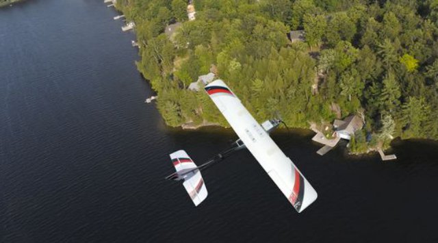
An announcement last week that researchers will soon fly a lightweight, self-guided drone over a farm near Batavia revealed that a federally backed project to test unmanned aircraft could reach farther into western New York than originally expected.
The flight in Genesee County will be the first overseen by operators of a drone testing program based at Griffiss International Airport in Rome, Oneida County. It’s one of only six sites in the U.S. where the Federal Aviation Administration said earlier this year it will allow tests to help regulators develop rules for pilotless aircraft to share the skies with traditional planes.
Two dozen states competed fiercely for those test sites, and local proponents had what seemed like a major advantage: access to a huge swath of restricted airspace along most of the U.S. side of Lake Ontario, where the military already flies its own drones. Applicants even called that airspace the “crown jewel” of their proposal last year.
“That kind of turned the whole model on its head,” said Larry Brinker, executive director and general counsel for the Northeast UAS Airspace Integration Research Alliance, a coalition of organizations from New York and Massachusetts that runs the testing program. UAS is short for unmanned aerial systems — industry parlance for drones.
The FAA wants NUAIR to operate in regular airspace because the program is all about learning how UAS and piloted aircraft can fly safely together, Brinker said. “This project is about integration and not segregation,” he said. The flight somewhere near Batavia — organizers wouldn’t say exactly where — may be the first of many in this region to explore how small drones equipped with sensors can help farmers.
Cornell Cooperative Extension, which worked with NUAIR to get federal permission for the flight in Genesee County, plans to apply for similar tests at farms in nine other counties, including Monroe, said Bill Verbeten, regional agronomist for the extension’s Northwest New York Dairy, Livestock and Field Crops team.
“Depending on the acres the farmers have committed to us, we’re looking at somewhere between 3,000 and 5,000 acres,” he said. “We’re really trying to capture most of the types of farms we work with and to see what’s consistent across farms and what’s different.”
Beyond Monroe and Genesee, the extension hopes to fly at sites in Ontario, Wayne, Yates, Seneca, Livingston, Wyoming, Orleans and Niagara counties. Verbeten said he hopes to have drones flying at 12 to 15 farms by spring of next year.
Cornell Cooperative Extension and NUAIR would have to apply separately to the FAA for each site. Meanwhile, Brinker said NUAIR also has seven other applications with the FAA for projects with different partners, most of them in Griffiss’ airspace. One would explore technology for drones to detect and avoid obstacles.
The FAA document authorizing the test in Genesee County was not immediately available, but Verbeten said flights would occur only at one farm within a roughly one-mile radius and less than 400 feet off the ground. Before that happens, an independent safety review board will go over the project and flight plan — a process that should take about two weeks, according to Brinker.
Researchers plan to work with a Lancaster Hawkeye Mk III made by PrecisionHawk. The fixed-wing plane weighs just 3 pounds and has a 4-foot wingspan. The device can be launched by hand, flies according to a preprogrammed path and lands itself, according to the manufacturer.
Verbeten said Cornell Cooperative Extension wants to test three types of sensors on the drone. One might be used to count plants and estimate crop yields. Another could capture thermal images of crops and spot potential pests or diseases, which workers could then scout out on the ground. A third camera might be able to help farmers to apply fertilizer more precisely.
Farmers or agricultural consultants already have some similar tools at their disposal, but researchers want to see whether they can be used more efficiently and at a lower cost from the air.
“We’re trying to figure out what scans at what time of year are most relevant for making management decisions,” Verbeten said. “That’s going to be critical for the eventual commercial use of these drones — actually having something that a farmer can make a decision with and not just take a pretty picture.”
NUAIR also will collect data from the Genesee County project on drone safety and performance.
Cornell Cooperative Extension wants to test this equipment on farms across the region to see how it can be used to monitor various crops grown in different terrain, Verbeten said. NUAIR said it expects the precision agriculture industry to be a major force in the market when commercial use of drones gets the FAA’s OK.
Source:http: Poughkeepsie Journal

