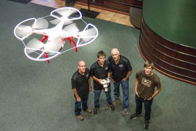
Assistant professor of computer science Dale Hamilton and associate professor of computer science Barry Myers weer awarded a NASA EPSCoR (experimental program to stimulate competitive research) Undergraduate Research Grant.
The purpose of the NASA EPSCoR Program is to provide areas of the country that have often lacked aerospace research more opportunities. The first round of funding was received last fall, which allowed research to begin the end of 2014.
The goal of the project, which has been dubbed FireMAP, is to “provide a responsive, affordable and safe tool to assist with the development of post fire recovery plans and for updating spatial fuel layers to reflect the effects of the fire on vegetation.”
Hamilton and Myers will use an off-the-shelf unmanned aerial system with an attached camera to gather and process data. The drone will be able to fly over affected areas after fires have been extinguished to assess and monitor the effects of the fire. The data obtained will be a significant piece in recovery planning. The use of the system is also an economical breakthrough, as, according to the U.S. Geological Survey, it is roughly 10 percent the cost of using manned aircraft.
In preparation for photographing wildfire burns, the FireMAP team collaborated with Tegan Byerly’s engineering class at Vallivue High School to calibrate the unmanned aerial system imagery. This collaboration was the result of the high school class wanting to contribute to the FireMAP project. By effectively marking a giant ruler across the Vallivue soccer field and flying the drone directly above a designated start point, the team was able to more accurately calibrate the spatial resolution of the imagery taken with the drone at varying heights. By more accurately defining the spatial resolution of the imagery, the FireMAP team was better prepared to go out into the wildfires and acquire more precise data.
This summer, the team used drones to photograph the aftermath of a wildfire, which allowed them to identify where the fire burned, what was burned, and in turn translate the imagery into usable data that can support prevention research.
“We are very encouraged by the ability of the prototype systems we built over the summer to classify wildland fire extent and severity from hyperspatial UAS imagery,” Hamilton said in a press release. “Our initial success in identifying where a fire burned as well as the vegetation types found outside the burn area bode well for the potential that can be achieved with future research.”
In addition to supporting the two faculty members, the grant will also provide opportunity for undergraduate computer science students to be involved in the FireMAP project. Six NNU computer science majors, freshman Nicholas Hamilton (Caldwell), senior Tim Mong (Coquille, Oregon), junior Peter Oxley (Emmett), senior Johnathan Hamilton (Caldwell), post bacc. Stacie Zaroban (Boise) and senior Genesis Cruz (Nampa) are the planned research assistants for the wildfire monitoring and assessment project.
PHOTO: COURTESY OF NORTHWEST NAZARENE UNIVERSITY Peter Oxley, of Emmett, Nicholas Hamilton, of Caldwell, Professor Dale Hamilton and Johnathan Hamilton, of Caldwell, fly “Ranch,” one of the drones used in the FireMAP research project.
Source: Idaho Press – Tribune

