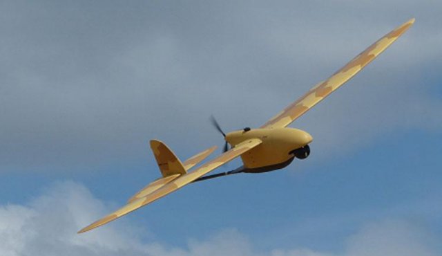
The system draws on a decade of experience of micro- and mini-UAV systems with the French armed forces and offers particularly high levels of endurance. It is deployed with the Spy’C automatic command-and-control software already adopted by the French land forces.
Designed to operate in extreme, non-permissive environments, this new-generation system gathers and transmits accurate, operational beyond-line-of-sight image intelligence for joint battle-group and brigade-level units. It is inter-operable with France’s multi-sensor image interpretation and dissemination system (MINDS/SAIM) to generate imagery that can be used directly in operational C4I systems for frontline mission planning and multi-sensor maneuvers by forward units.
Thales is Europe’s leading industry player in tactical UAV systems and intends to become the European leader across the entire sector with a complete offering of unmanned systems ranging from micro-UAS to tactical UAVs.
Capabilities
Surveillance
The range and endurance of the Spy’Ranger system, combined with the efficiency of its EO/IR sensor, advanced processing capabilities and a tactical datalink developed specifically for the French forces, make the system suitable for any type of point or wide-area surveillance during the day or at night.
Reconnaissance
Spy’Ranger gathers key intelligence data on movements of potential threats, non-combatants and friendly forces to help ensure mission success during joint maneuvers at brigade level. The system tracks battle-group movements on offensive reconnaissance or survey missions, determining threat locations and providing detailed topographic information in real time.
Image intelligence
On front-line intelligence missions, Spy’Ranger gathers and transmits images in real time, either for immediate interpretation to meet the needs of an ongoing operation, or for further exploitation to support joint mission planning or battle damage assessment.
Target acquisition
Spy’Ranger identifies and geolocates targets in real time to provide direct support to maneuvers by engaged forces. Its high-definition imaging system and laser pointer indicate the exact location of a target. Geographic data is automatically added so that the intelligence can be used immediately by fire control systems (artillery, mortars, aircraft, etc.) to help protect the forces in the field and gain a tactical advantage.
Spy’Ranger performance
– Operational endurance: > 2 hours 30 minutes
– Adjustable ground speed
– Operates with wind speeds in excess of current type standards
– Innovative, lightweight launch system for take-off in any direction, from constrained areas, even with no wind
– Designed for highly accurate landing in complex zones (obstacles, constrained areas, etc.)

