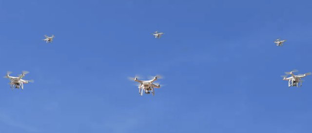
the developer of cloud based software that enables organizations to operate autonomous drone fleets for the acquisition, management and processing of field data, gave today a sneak preview of its new software release scheduled for November 2017 at the Drone World Expo in San Jose, CA.
“vHive’s new release further expands its capabilities as a true enterprise drone solution: scalable, safe and efficient”, said Yariv Geller, vHive’s CEO. “A growing number of industries are adopting drones as important work tools, but are discovering that it is difficult to scale operations. vHive’s technology is first to solve the complexity of planning and executing multi-drone missions of any size or shape, enabling them to complete – faster and cheaper. Organizations are finding that by merely adding a second drone to a mission they can halve their precious time in the field”
“vHive’s Mission AI™ takes into account a broad set of parameters to effectively manage autonomous multi-drone missions in real time.”, said Tomer Daniel, vHive’s CTO. “The system continuously evaluates the goal of the mission as outlined by the user a d the drones available and their capabilities while satisfying a variety of mission constraints such as safety, regulation, environmental as well as real time mission events, to deliver the most effective mission performance. vHive’s missions are not pre-scripted but rather adapt to the ongoing dynamics of the field bringing true collaboration between participating drones”.
vHive started in 2016 as the first company to develop an artificial intelligence solution to manage drone fleet missions for enterprise use. Over the past few years, many organizations have embraced drones as rapid, accessible and precise tools to collect field data, though for the most part in simple, small-scale missions. vHive’s Mission AI™ enables organizations and drone operators to manage missions of any scale or shape. The company currently provides aerial surveying and inspection solutions in industries such as Civil Engineering, Construction, Infrastructure and Utilities, creating a digital representation of assets and field operations in 3D space and over time.
Source: Press Release

