The California High Speed Rail Authority (CHSRA) is planning the first dedicated high-speed rail system in the U.S. When completed, it will enable passengers to travel from San Francisco to Los Angeles in under three hours, at speeds greater than 200 mph.
Two segments of high-speed right-of-way that need to be built for this project cover 42 miles in Southern California—12 miles between Burbank and Los Angeles and 30 miles between Los Angeles and Anaheim. CHSRA knew that the environmental and infrastructure impacts of this project would be considerable, with consequences for rights-of-way, waterways, traffic, overhead structures and other infrastructure along the corridor. The Authority engaged Jacobs/Zephyr UAS to develop preliminary engineering design plans to support an environmental assessment of the potential impact of this $3 billion project.
“Ours is a project for the 21st century employing 21st century technology, so we want to make sure that we do everything better, faster, and more economically,” says CHSRA Southern California Director Michelle Boehm. “We needed to obtain detailed mapping of our corridor quickly.”
Given the project’s tight schedule, the need to collect data in live corridors and the constant survey interruptions due to traffic, creating the plans was not an easy task. Yet, the team developed a way to safely and efficiently survey the corridors, and deliver an accurate and complete assessment to support the environmental assessment, by using technology developed by Bentley Systems.
Capturing Point Clouds
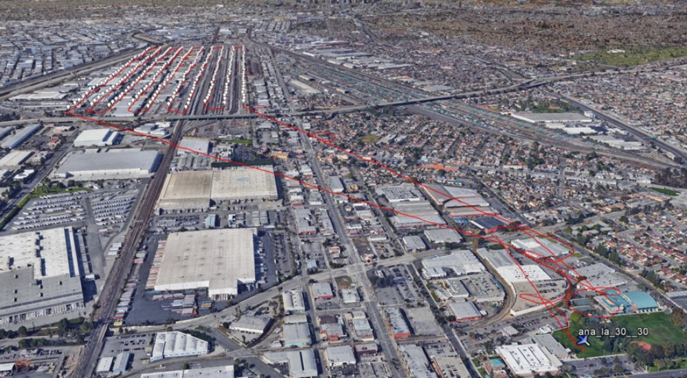
One of the major challenges the Jacobs/Zephyr UAS team faced was obtaining accurate, up-to-date aerial mapping of both segments because they both lie in densely populated regions along an active railroad corridor that carries up to 100 trains per day. The design team had hoped to use aerial mapping collected several years earlier, but this data was incomplete and lacked satisfactory resolution. As a result, Jacobs/Zephyr UAS needed to find a way to capture data that would keep survey crews safe, minimize interruptions due to train traffic, and avoid the hassles of obtaining permits to access the railroad right-of-way.
To overcome these challenges, the engineering team decided to use unmanned aerial vehicles (UAVs) to obtain aerial mapping of the rail corridor. UAVs could fly at lower altitudes than manned aircraft and would require only 82 ground control points (GCPs) for all 42 miles of mapping. Equally important, the data collected would provide an extremely rich color ortho aerial illustration at one-inch per pixel resolution supporting one-foot contours and actual observed accuracy of better than two inches for digital terrain models (DTMs).
This approach allowed the survey team to determine right-of-way impacts with improved accuracy while reducing the time, cost and environmental footprint of the project. The project was completed within eight weeks, as opposed to 18 weeks using traditional aerial mapping with manned vehicles—a 56% reduction in delivery time, an 87% reduction in costs and a four-times increase in aerial imaging quality.
Finally, UAV mapping produces data known as “point cloud files,” which the project team imported into Bentley software to rapidly create 3D models.
Software-Driven Engineering
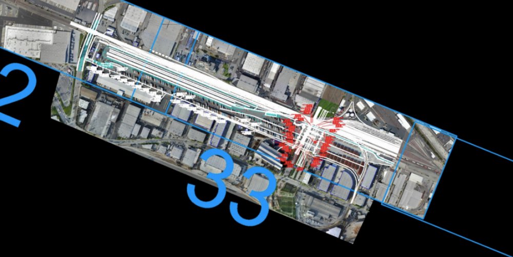
Once the mapping data was collected from the UAVs and processed, Jacobs/Zephyr UAS prepared base maps for the track plan and profiles using Bentley’s MicroStation and Power Rail Track tools. Using the point cloud files, the project team combined cloud capabilities with the powerful POD (Plain Old Documentation) format within MicroStation to immediately check the aerial data produced from the UAVs.
MicroStation’s functionality enabled the team to interactively work with native point cloud data referenced directly into its DGN CAD file format and run Power Rail Track alignments interactively, resulting in significant efficiencies. For example, Jacobs/Zephyr UAS eliminated several conversion steps using embedded Bentley capabilities, which took one week off the design process.
In addition, the organization utilized ProjectWise to facilitate secure, efficient file sharing, distribution and version control across a geographically distributed team and set of stakeholders. This was essential, as Jacobs/Zephyr USA had to engage geographically distributed teams to meet the aggressive deadline. With ProjectWise, everyone worked together seamlessly, sharing files and ensuring version control effortlessly and around the clock.
One Step Closer To HSR
The combination of MicroStation, Power Rail Track and ProjectWise were essential to the success of this project, all of which helped Jacobs/Zephyr UAS establish a workflow that expedited project delivery and improved quality. When coupled with the innovative UAV technology data collection process, these technologies delivered major benefits for Jacobs/Zephyr UAS, most notably, accurate preliminary engineering plans that were developed faster and at a much lower cost. In addition, the results have been positive. CHSRA has been appreciative of the innovative and expeditious manner in which Jacobs/Zephyr UAS produced the plans. The company is now recognized as a leader in the integration of UAVs with infrastructure design.
Images: Bentley
Source: Railway Age


