In a changing climate, wildfires are becoming more widespread and devastating, threatening more people and land than ever before. In response, NASA is stepping up to the plate to determine what we can do to help fight wildfires – and we have some ideas.
NASA has long been involved in wildfire management through the Science Mission Directorate (SMD) using space-based technologies and other systems. Now, the Aeronautics Research Mission Directorate (ARMD) is getting involved as well.
“With new innovative aviation technologies now available, NASA can actively support the efforts to curb wildfires,” said Robert Pearce, NASA’s associate administrator for Aeronautics. “We’re helping those on the front lines to more safely and quickly identify and stop these disasters.”
In May 2021, NASA Aeronautics hosted a wildfire management workshop. Our aeronautical innovators met with representatives of several firefighting and wildfire management organizations from government, industry, and academia with the goal of learning their specific needs.
Parimal Kopardekar, director of the NASA Aeronautics Research Institute, facilitated the workshop alongside Laurie Grindle, director of programs and projects for NASA’s Armstrong Flight Research Center in California.
“Each year, fire season starts earlier and lasts longer, resulting in more acres burned and more homes and other structures lost than the previous year,” said Grindle. “We designed this workshop to figure out how NASA can help.”
The result was a productive series of discussions between NASA’s ARMD and SMD, the U.S. Forest Service, U.S. Geological Survey, the California Department of Forestry and Fire Protection (CAL FIRE), and several others that sets the stage for what could become a new future in preventing and fighting wildfires.
That possibility could see the regular use of Unmanned Aircraft Systems (UAS) like drones, and stems from the progress made by NASA’s work in Advanced Air Mobility and UAS Traffic Management – research designed to greatly expand how and where these types of aircraft can safely be flown.
What We Learned
The one-day workshop was organized into a general session and separate breakout sessions focusing on these five topics: planning for fire season, prediction modeling and challenges, aerial fire surveillance, suppression and mitigation, and post-fire remedial efforts.
Each session hosted a cross-section of experts from government, industry, and academia who explained and discussed how wildfire management currently works and identified specific areas where NASA technology could make improvements.
For example, a small remotely piloted UAS with vertical takeoff and landing capabilities could reach the site of a wildfire, provide up-close imagery, and leave the area well before crewed aircraft could arrive. These aircraft could also be equipped with remote sensing technology that is able to detect and map heat, dangerous fumes, and erosion of landscape due to a fire.
Additionally, a UAS may be able to deliver fire retardant – that is, actively put out fires – with remote sensing and other capabilities onboard. A UAS would act as a surgical firefighting tool, targeting smaller parts of a fire in harder-to-reach places, even in low visibility conditions.
Not only can a UAS perform these tasks quicker and more precisely than a larger, manned aircraft flying higher above the fire, but it can also fly these missions with much lower risk and cost.
Another issue discussed during the workshop was how the speed of data capture and information sharing about fires could be quicker than it is now. It was noted that NASA’s work in airspace operations and communication may provide feasible solutions that would help firefighters get the information they need sooner.

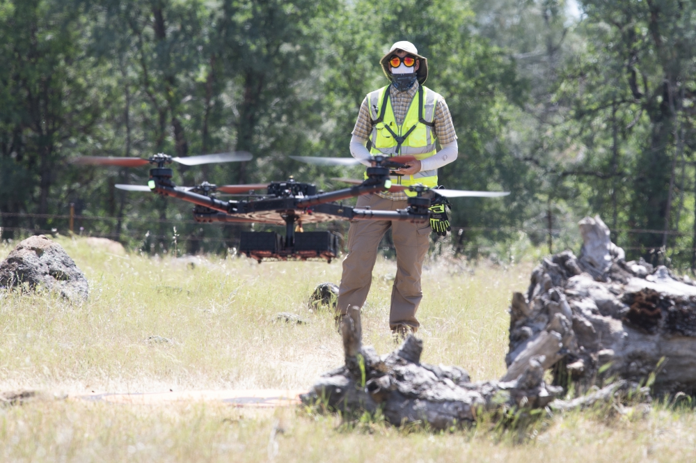
NASA drone pilot Jonas Jonsson flies an unmanned aircraft during a flight demonstration in California in May 2021
What We Are Doing
Since the workshop, each NASA field center that conducts aeronautics research has been adapting, developing, and testing technologies that could make a difference in wildfire management.
Researchers at NASA’s Glenn Research Center in Cleveland have looked at potentially applying their work in technologies such as remote sensing, thermal imagery, heat resistant hardware, and advanced communication systems to wildfire management overall.
“Hyperspectral and thermal sensors could map the location of a fire, its size, and how fast it is growing. With this capability, a remotely piloted aircraft can gather very detailed, precise information that can be transmitted in real time to firefighters,”
said John Lekki, a researcher at NASA Glenn working on hyperspectral imagery.
With heat-resistant hardware, the aircraft carrying these sensors can more safely venture where firefighters are not able. And with advanced communications systems, each aircraft can better communicate with each other and with firefighters.
Meanwhile, researchers at NASA Armstrong are considering applying capabilities from the Resilient Autonomy project to wildfire management by tailoring software they are testing that includes advanced sensing capabilities in order to deliver precision-strike retardants using a network of aircraft.
Another active example among NASA’s wildfire management activities is the Scalable Traffic Management for Emergency Response Operations, or STEReO.
STEReO envisions a new system for wildfire response with three broad goals: reducing response times, scaling up the role of aircraft, and providing operations that can adapt to rapidly changing conditions during a disaster.
In other words, STEReO is working on bringing the ideas and capabilities discussed in the workshop to life.
STEReO team members from NASA’s Ames Research Center in California recently partnered with the U.S. Forest Service to conduct simulated flight tests of UAS using real data from firefighting aircraft. The activity has also studied real-world firefighting conditions with CAL FIRE.
As part of their work on wildfire management, researchers at NASA’s Langley Research Center in Virginia have conducted a flight test called the Initial Airborne Assessment, which tested several autonomous systems onboard an unmanned aircraft designed for wildfire management.
“The aircraft had Detect and Avoid technology onboard, which helped it maintain safe separation from others flying nearby, and also tested autonomous emergency landing capabilities,” said Robert McSwain, who heads up Langley’s efforts on STEReO. “Each aircraft’s flight path simulated how real U.S. Forest Service aircraft operate around wildfires.”
The full report detailing the workshop’s discussions can be found here.
John Gould
Aeronautics Research Mission Directorate
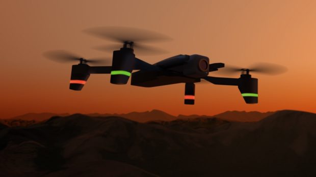
Top Photo: Illustration of an Unmanned Aircraft System, or drone, in front of a smoke-filled sky


Sagita in Belgium is looking for partnership to develop the S110 VTOL drone for fire fighting operations.
S110 is designed for compactness and long endurance. It is based on the S75 prototype.