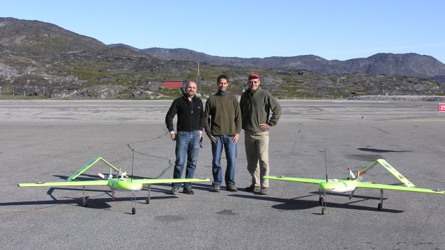
CU-Boulder Research Professor James Maslanik, left, CU-Boulder graduate student Ian Crocker, centre, and NOAA researcher John Adler, right - Photo : University of Colorado
A national research team led by the University of Colorado Boulder is embarking on a two-year, multi-pronged effort to better understand the impacts of environmental factors associated with the continuing decline of sea ice in the Arctic Ocean.
The team will use tools ranging from unmanned aircraft and satellites to ocean buoys in order to understand the characteristics and changes in Arctic sea ice, which was at 1.67 million square miles during September 2011, more than 1 million square miles below the 1979-2000 monthly average sea ice extent for September — an area larger than Texas and California combined. Critical ocean regions north of the Alaskan coast, like the Beaufort Sea and the Canada Basin, have experienced record warming and decreased sea ice extent unprecedented in human memory, said CU-Boulder Research Professor James Maslanik, who is leading the research effort.
The team will be targeting the Beaufort Sea, considered a “marginal ice zone” where old and thick multiyear sea ice has failed to survive during the summer melt season in recent years, said Maslanik of CU-Boulder’s Colorado Center for Astrodynamics Research in CU’s engineering college. Such marginal ice zones are characterized by extensive ice loss and a strong “ice-albedo” feedback.
The new $3 million study led by Maslanik, “The Marginal Ice Zone Observations and Processes EXperiment,” or MIZOPEX, is being funded by NASA.
The team will undertake extensive airborne surface mapping using a variety of Unmanned Aircraft Systems, or UAS, comparing the results with data collected by a fleet of satellites from NASA, the National Oceanic and Atmospheric Administration and the Japanese space agency.
The MIZOPEX arsenal also will include floating buoys that measure ocean temperatures. CU-Boulder engineering faculty members Scott Palo and Dale Lawrence and their graduate students are converting miniaturized versions of dropsondes — standard weather reconnaissance devices designed to be dropped from aircraft and capture data as they fall toward Earth — into the buoys that will be deployed by the UAS.
The modified dropsondes, which were developed at CU-Boulder for use in Antarctica, will be combined with CU-designed miniature unmanned aircraft that will land on the ocean near sea ice floes. Such floes are critical to several species of Arctic wildlife, including polar bears, walruses and seals.
The buoys and unmanned craft will collect sea surface and subsurface temperatures to about a meter deep, while the overflying unmanned planes and satellites measure temperatures at the surface, Maslanik said. “We want to know if the warming is just at the ocean surface or if there is additional heat getting into the mixed layers of the upper ocean, either from absorbed sunlight or from ocean currents, that could be contributing to sea ice melt.”
Source: Press Release

The story should also have noted that all the proposed UAS operations are contingent on obtaining the required “Certificate of Authorizations” from the Federal Aviation Administration. We’re beginning to work on that process now.