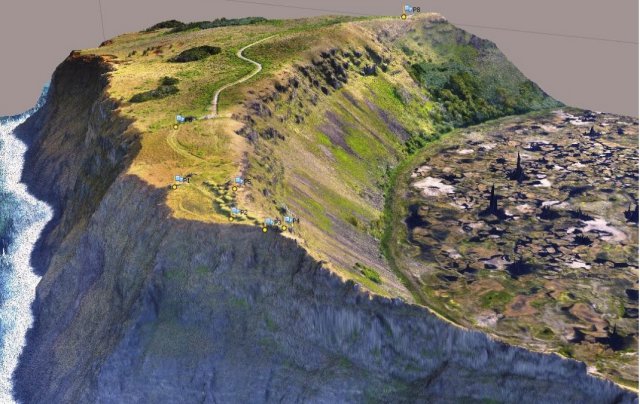
 Edafica, a Chilean environmental management and consulting company has successfully performed the acquisition of aerial images at Rano Kau volcano located in the south-west corner of Easter Island.
The operation was completed by two flights (cruise altitude of 582 meters above the Ground Control Station) on May 21st, under environmental and logistics conditions which required significant technical and human efforts, facing strong winds, rugged physiography dominated by the volcano and changing weather conditions, all of this added up with the permanent shading in the south cliff, dropping steeply to the sea as a 300 meters structure, which was the main objective of analysis required by the project.
The digital surface model (DSM) generated with 1282 images was supported with a set of ground control points obtained by DGPS equipment. The information is valuable for conservation assessments purposes of the site and aims the precise determination of the structural geological condition of the Ngarahu Mata area, at the Orongo village, listed as one of the 100 sites at risk by the World Monuments Watch (WMW).
Edafica operate sUAS Stardust provided by IDETEC Unmanned Systems, which has been used in a wide range of projects with proven capabilities to obtain high quality images with accurate GPS and IMU data.
Edafica and IDETEC Unmanned Systems sincerely thanks the active role of the Chilean aviation authority (DGCA – Direccion General de Aeronautica Civil) in granting the permission for carrying out the operation in the Air Traffic Zone of the Easter Island International Airport.
Source: Press Release
