This video was created with the permission and supervision of the Mexico City International Airport authorities, and in close contact with the control tower and pilots. Continue reading
Category Archives: Aerial Photography
Drone-on-a-Leash
Sergei Lupashin, who has created a clever little device called the Fotokite. Essentially, he put the camera drone on a leash. Continue reading
Pro Snowboarder Creates Autonomous Camera HexoCopter
Xavier de la Rue has been a pro snowboarder since he was 17 and has been world champion seven times. Although he still boards, de Le Rue’s life has recently taken a different course, he tells the audience at the Pioneers Festival in Vienna. He is now also a filmmaker, an inventor and a tech entrepreneur. Continue reading
Goose Attacks DJI Phantom on Golf Course
Golf-course aerial photography by QuadCopter (at least in the areas where they’re legally allowed to fly) is all the rage at the moment. These small, pilotless, radio-controlled devices can capture golf-course views you used to need a chopper to get — or couldn’t get at all. Continue reading
UAS Give Perfect Vision of Polo
The use of UAS mounted cameras will play significant part in enhancing polo’s coverage, according to the sport’s leading live streaming service.The size of the field, lack of video replays and watching from pitch level – largely from afar – has often given newcomers to the sport a hard task in understanding polo’s dynamics. Continue reading
Unmanned Aerial Spy Photography from 1907
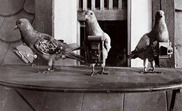
 In 1914, early on in the new Great War, one German inventor thought his way of taking photographs from the sky would be able to help the small number of airplanes available for the job. Back in 1907 Julius Neubronner had invented a small, automatic camera that could be strapped to a homing pigeon (these birds were already widely used by armies for carrying messages).
Manned UAVs Cost Half of UAS with No Restrictions
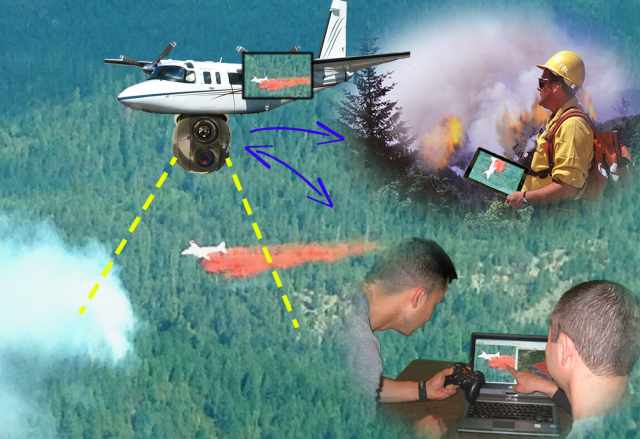
 SkyIMD is a one-stop source for deploying an aerial surveillance system which usually involves multiple technologies and providers. The company is now promoting a new service using manned UAVs equipped with gyro stabilized gimbals and geomatic cameras pre-programmed to automatically follow GIS (Geographic Information System). The camera systems can be live controlled and viewed from the ground over an unlicensed microwave link. A 6 hour/500 mile duration is more than most drones, yet operational costs are less, and there are no flight restrictions (day/night, IFR/VFR, urban areas, altitudes).
Plexi Drone Aims to Simplify Aerial Filming
A Toronto startup is launching a campaign to send swarms of lightweight cameras into the skies. The PlexiDrone is a small quadcopter with a snap-in socket for lifting a variety of prosumer devices skyward, from point-and-shoots to GoPros. DreamQii, the company behind the PlexiDrone, boasts that the aircraft’s design lets users capture 360 degrees of footage without propellers or landing gear getting in the way. Continue reading
