
A highly-controversial drone video surfaced online that seems to have been captured illegally. In it, the pilot flies shocking close to the US Navy Blue Angels as they performed an “America Strong” flyover in Detroit on May 12th. Continue reading
Category Archives: Aerial Photography
Surveyors Measure Coastal Erosion Using UAS
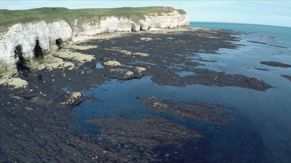
AG Survey recently used control targets, GNSS receivers and UAS technology in a race against the tides and weather to survey 80 different beaches along England’s southwest coast. The project was part of a national coastal monitoring program funded by England’s Department of Environment, Food and Rural Affairs and run through the Environment Agency (EA) to collect topographic beach surveys around the country. Continue reading
Drone Zooms through Mercedes-Benz’s Stuttgart Museum
https://youtu.be/sSrL1daFcPI
The Mercedes-Benz Museum in Stuttgart closed in mid-March because of the coronavirus outbreak. On Saturday, 9 May 2020, it opened its doors to the public again. Continue reading
Hummingbird Drone Video Inside a Butterfly Swarm
The PBS show Nature recently released this clip from its ‘Spy in the Wild’ series that will take your breath away. Using a drone disguised as a hummingbird, they captured incredible footage of 0.5 billion monarch butterflies swarming as the weather warms. Continue reading
Golf Ball Downs Drone
https://youtu.be/KAU8RFtgH1Q
Matthias Schwab, a Professional Golfer from Austria, made a ‘drone-in-one.’ As the European Tour pro tees off at a golf course in Schladming, Austria, a drone to his right shoots past while recording a video posted to Schwab’s Instagram account on Friday. Continue reading
NYPD Seizes Drone of Photojournalist Documenting Mass Burials on Hart Island
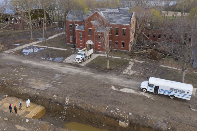
The NYPD seized the drone of a photojournalist documenting the mass burials on Hart Island amid the coronavirus crisis. Continue reading
Aerial Applications Gets $6M of USAF R&D Funding
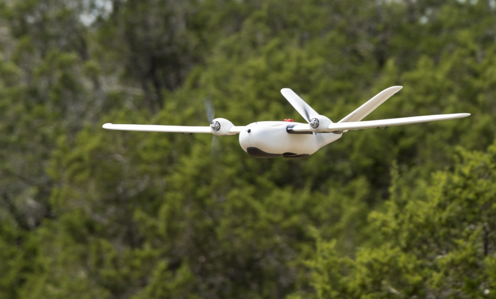
An unmanned aerial system flies over Camp Bullis, Texas, during a field test Sept. 4. The UAS was equipped with Light Detection and Ranging, multi-spectral sensors and machine-learning algorithms
Aerial Applications, a software company specializing in GPU-accelerated data processing of drone imagery to make maps, has been awarded the US Air Force Small Business Innovation Research (SBIR) Phase II B Strategic Fund Increase Pilot Program. Continue reading
Elistair Tethered Drone System Supports 13 Hours of Live Aerial Footage of Democratic Debate

On January 14, 2020, for the first U.S. Democratic debate of the year held on Drake University campus in Des Moines, Iowa, CNN deployed an Elistair tethered system with the support of Vector Solutions, product reseller and tether expert, to provide persistent aerial video transmission of the area. Continue reading